Lustūža klintis / Lustuzis Cliffs
概览
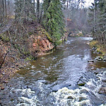
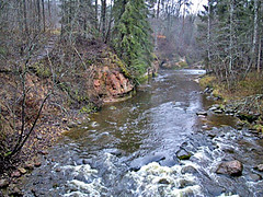
Ap 140 metrus plats, līdz 3.5 metrus augsts iezis, kuru visā garumā apskalo Amata. Upe asajā līkumā turpina klinti izskalot.
Austrumos no Vanagu ieža, Amatas labajā krastā.
Approximately 140 metres wide, up to 3.5 metres high cliff. Amata flowing along it along whole length. River continues to erode it in sharp bend.
East from Vanagi cliff, right bank of Amata.
Location:
Javascript is required to view this map.
评论
Connections
Compare related sites, explore the related maps, find out about volunteering, how to get here and more. Soon, you will find ways to share this map here, too.
Every site using the same primary Icon on Open Green Map is automatically linked here. You can compare different approaches and solutions on this map and others around the world.
Choose a connections category from the list on the left.
Other Sites on Map
Related Sites Worldwide
-
- Gainesville美国
- 葡萄牙
- Hong Kong中国香港特别行政区
-
-
-
-
- 阿鲁巴
- 意大利
- Gainesville美国
- 美国
- Boiling Springs美国
- 葡萄牙
- 葡萄牙
-
- 瑞士
-
- Lincoln美国
-
-
-
-
-
- 瑞士
Impacts
No impacts have been left for this site yet - be the first!


 added by


