sudbury
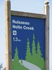
Rainbow Routes Association Nolin Creek Walking Loop
Übersicht


This easy walking trail runs along Nolin Creek. The McNeil Blvd entry to the trail has tiered decking perfect for social gatherings. Visitors will walk a total of 1.3 km by adding the sidewalk of McNeil Blvd to the loop. The walk leads to a Gazebo and park area that is perfect for a picnic

Location:
Javascript is required to view this map.
Kommentare
Verbindungen
Compare related sites, explore the related maps, find out about volunteering, how to get here and more. Soon, you will find ways to share this map here, too.
Every site using the same primary Icon on Open Green Map is automatically linked here. You can compare different approaches and solutions on this map and others around the world.
Choose a connections category from the list on the left.
Andere Orte auf der Karte
Ähnliche Orte weltweit
- South Korea
- QueretaroMexico
- United States
- JacksonvilleUnited States
- CardiffUnited Kingdom
- Lebanon
- South Korea
- GoshenUnited States
- DentonUnited States
-
- VeniceUnited States
- SarasotaUnited States
- VeniceUnited States
-
- FlorianopolisBrazil
- Copper Harbor
- Mooi RiverSouth Africa
- United States
- BerlinGermany
- TrentonUnited States
- MontclairUnited States
- SarasotaUnited States
- Canada
- United States
- South Africa
Multimedia

 Hinzugefügt von


Auswirkungen
No impacts have been left for this site yet - be the first!


