sudbury
Rainbow Routes Association Nolin Creek Walking Loop
このサイトについて


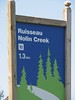
This easy walking trail runs along Nolin Creek. The McNeil Blvd entry to the trail has tiered decking perfect for social gatherings. Visitors will walk a total of 1.3 km by adding the sidewalk of McNeil Blvd to the loop. The walk leads to a Gazebo and park area that is perfect for a picnic

Location:
Javascript is required to view this map.
コメント
コネクション
ここでは、関連したサイトと比較、地図の探索、ボランティアについてやこのサイトへの行きかたなどがわかります。
このグリーンサイトと同じ第一アイコンを指定しているサイトは自動的にここに表示されます。ここに表示されているほかのサイトを見て比較してみよう。
Choose a connections category from the list on the left.
この地図にある関連サイト
世界中の関連サイト
- New YorkUnited States
- Cape TownSouth Africa
- Cape TownSouth Africa
- Lebanon
- United States
- United States
- BronxUnited States
- Canada
-
- Petit Lancyスイス
- South Africa
-
- SarasotaUnited States
- Brazil
- South Africa
- VeniceUnited States
- CuritibaBrazil
- South Korea
- Baltimore, MDUnited States
- United States
- United States
- North PortUnited States
- United States
- SpencerUnited States
- Den HaagNetherlands
マルチメディア

 added by


インパクト
まだ誰からもインパクトは報告されていません!一番目になりませんか?


