Centralia Paper Mill
Overview


Marker commemorates the birth of the Wisconsin River paper industry at this site in 1887. Located on Highways 73 & 54 at the south edge of Wisconsin Rapids.

Location:
Javascript is required to view this map.
Comments
Connections
Compare related sites, explore the related maps, find out about volunteering, how to get here and more. Soon, you will find ways to share this map here, too.
Every site using the same primary Icon on Open Green Map is automatically linked here. You can compare different approaches and solutions on this map and others around the world.
Choose a connections category from the list on the left.
Other Sites on Map
-
-
- Wisconsin Rapids
- Wisconsin Rapids
-
- Stevens Point
-
Related Sites Worldwide
- United Kingdom
- FifeUnited Kingdom
- Schooley's MountainUnited States
- United States
- OcracokeUnited States
- BaltimoreUnited States
- 宇治市Japan
- GloucesterUnited States
- United States
- Canada
- New YorkUnited States
- United Kingdom
- SavageUnited States
- Smith TWPCanada
- YarmouthCanada
- SarasotaUnited States
- Taiwan
- YarmouthCanada
- New YorkUnited States
- sea levelUnited States
- YarmouthCanada
- GloucesterUnited States
- São JoséBrazil
- United States
-
Multimedia
 added by
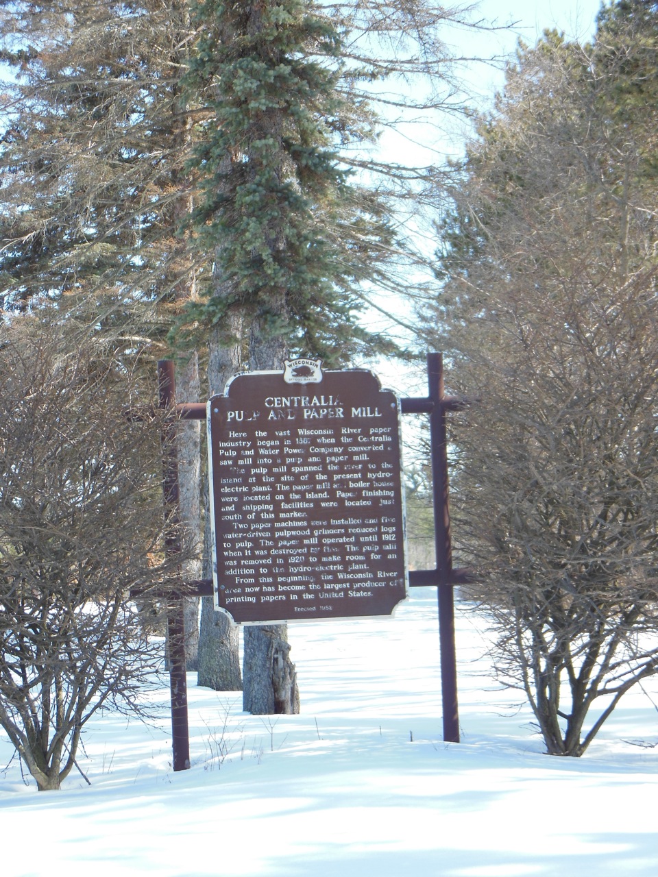
Impacts
No impacts have been left for this site yet - be the first!


