Bancroft WaterFront Park
![Waterfront/Riverside Park: Place where you can relax, walk or ride along and play by the water (includes water bodies of all types). May include a beach; swimming and wading may be possible. Waterfront/Riverside Park](https://www.opengreenmap.org/sites/default/files/taxonomy_image/category_pictures_62.gif)
![Bicycle Path >: Designated and recommended bicycle paths or lanes. Bicycle Path >](https://www.opengreenmap.org/sites/default/files/taxonomy_image/category_pictures_167.gif)
![Wetlands: May be on an official protection list, as wetlands are important habitats and useful for water cleaning and protection from storm surges. May be natural, reconstructed or artificial. Wetlands](https://www.opengreenmap.org/sites/default/files/taxonomy_image/category_pictures_64.gif)
![Eco-Tour/Nature Walk: Marks the beginning of a hiking trail, guided tour starting point or an interesting walk. Maps, signage and information may be found here. Eco-Tour/Nature Walk](https://www.opengreenmap.org/sites/default/files/taxonomy_image/category_pictures_97.gif)
![Cleaned-Up/Rebuilt Site: A previously contaminated (or disaster) area that has been restored and remediated for safe public use, according to environmental standards. Can include brownfield remediation sites, development sites with soil/groundwater cleanup efforts, or reclaimed cleaned-up land such as urban parks and gardens. Cleaned-Up/Rebuilt Site](https://www.opengreenmap.org/sites/default/files/taxonomy_image/category_pictures_69.gif)
![Duck Pond: Typically a man-made body of water, ideal for watching ducks, geese, swans and other waterfowl. Usually smaller than a lake, may include ponds for recreational use. Duck Pond](https://www.opengreenmap.org/sites/default/files/taxonomy_image/category_pictures_91.gif)
![Eco Landscaping: Place where the land is beautified in an ecologically sustainable manner. Eco Landscaping](https://www.opengreenmap.org/sites/default/files/taxonomy_image/category_pictures_71.gif)
![Scenic Vista: Favorite places to see what makes the community's environment special. Scenic Vista](https://www.opengreenmap.org/sites/default/files/taxonomy_image/category_pictures_105.gif)
![Sunrise/Sunset Site: Wonderful public place to relax and enjoy the sunrise or sunset. Sunrise/Sunset Site](https://www.opengreenmap.org/sites/default/files/taxonomy_image/category_pictures_106.gif)
Overview
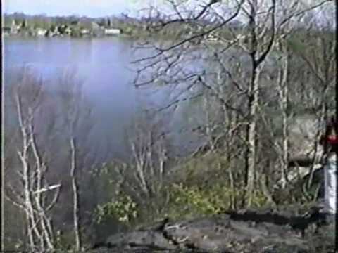
The Park was the project of the Minnow Lake Restoration Group winner of the 2006 Community Builders Award for the Environment. In addition to the boardwalk, 3 Nature trails are co-located leading to a Scenic Hilltop Gazebo, and Bancroft Drive has sports fields and good bike lanes. The lake is the focal point for the neighborhood or community that extends from almost downtown Sudbury, along Howey Drive, Bellevue and Bancroft to Moonlight Avenue, and from the Kingsway south to Lake Ramsey. Minnow Lake has the largest public shoreline (relative to size) of any lake in the area. The lake has four park areas on its shores and another adjacent to the lake. In addition there is an Arena, two ball fields and tennis courts. There are two community centers also located on the lake itself.
Location:
Comments
Connections
n/a
- RichmondUnited States
- United Kingdom
- JacksonvilleUnited States
- United Kingdom
- SarasotaUnited States
-
- GenèveSwitzerland
- CuritibaBrazil
-
- SwanseaUnited Kingdom
- OspreyUnited States
- United States
- CaliColombia
- United States
- ParramattaAustralia
- Saint LouisUnited States
- MalmöSweden
- Stevens PointUnited States
- PalmasBrazil
- New YorkUnited States
- San FranciscoUnited States
- North PortUnited States
- DubuqueUnited States
- Canada
- San AntonioUnited States
Multimedia
Minnow Lake Activity 1990