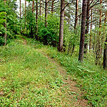
Grebļa kalns (Šķaunes oss, Kausas kalns) / Grebla Kalns (Skaune esker, Kausa Hill)
Übersicht
Ap 5 kilometrus gara, līdz 30 metrus augsta osu grēda. Oss ar pārdesmit metrus platu zemes strēli atdala divus ezerus. Dabas taka.
Starp Pintu un Šešku ezeriem.
Approximately 5 kilometres long, up to 30 metres hig esker. Esker with a narrow land spit is separating two lakes. Nature trail.
Between Pintas and Seski Lakes.
Location:
Javascript is required to view this map.
Kommentare
Verbindungen
Compare related sites, explore the related maps, find out about volunteering, how to get here and more. Soon, you will find ways to share this map here, too.
Every site using the same primary Icon on Open Green Map is automatically linked here. You can compare different approaches and solutions on this map and others around the world.
Choose a connections category from the list on the left.
Andere Orte auf der Karte
Ähnliche Orte weltweit
- United Kingdom
- PereiraColombia
-
- GainesvilleUnited States
-
- Brazil
- Lebanon
- Switzerland
-
-
- United States
- United Kingdom
-
- Brazil
- Italy
- Saint Lucia
- United States
- United States
-
- Saint Lucia
- NatalBrazil
- United States
-
- United States
-
Auswirkungen
No impacts have been left for this site yet - be the first!


 Hinzugefügt von


