Punggol Waterway
このサイトについて

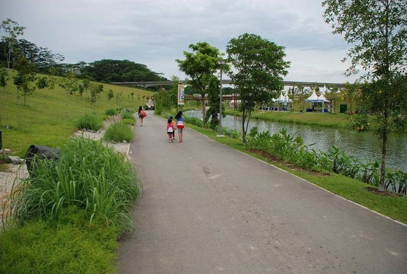
Punggol Waterway is Singapore’s longest man-made waterway. The 4.2km-long waterway connects Punggol Reservoir to Serangoon Reservoir, while treating visitors to a glimpse of Punggol’s old charm and heritage.
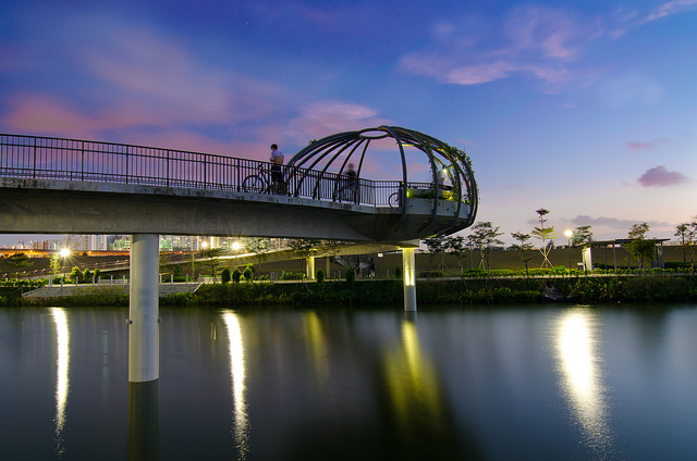
Officially opened on 23 Oct 2011, My Waterway @ Punggol has pedestrian and cycling paths on both banks and viewing platforms for visitors to enjoy the scenic views. The five bridges each offer a different perspective of Punggol, bringing visitors closer to the waterscape. Set amidst lush greenery, the space also has exercise and water-play areas for leisure activities.
The waterway combines a series of eco-features to naturally cleanse water naturally before it reaches the waterway. For example, eco-drains, or shallow drains made of gravel are found on both banks – where surface run-off water is filtered through the gravel layers. In addition, there are about 15 types of water plants on the waterway slopes to cleanse surface run-off.
Visitors will also notice mangroves at the Eastern end of Punggol Waterway. Mangroves help enhance water quality by absorbing nitrates and phosphates, thus decreasing and regulating algae growth in the water. This in turn promotes biodiversity, ensuring a safe haven for birds, monitor lizards and mudskippers to thrive in.

Location:
コメント
コネクション
N/A
- EspooFinland
- Caliコロンビア
- VeniceUnited States
- United States
- MadisonUnited States
- United States
- Bedford StuyvesantUnited States
- SarasotaUnited States
- SarasotaUnited States
- ドイツ
- San FranciscoUnited States
- Longboat KeyUnited States
- Hong Kong S.A.R., China
- Cluj-NapocaRomania
-
- United States
-
-
- Caliコロンビア
- Canada
- Caliコロンビア
- 台湾
- South Africa
- Puerto Rico
- BaltimoreUnited States
マルチメディア
 added by


インパクト
まだ誰からもインパクトは報告されていません!一番目になりませんか?


